Windsor Road to Yahara Heights County Park:
A disappointing section of the Yahara River which is fraught with deadfall and other obstructions. This trip will frustrate all but gluttons for punishment and paddling masochists.
Rating: ☆ ☆
Trip Report Date: April 9, 2016
Skill Level: Beginner
Class Difficulty: Riffles
Gradient:
4′ per mile (first 3 miles), then 2′ per mile, then <1′ per mile.
Gauge Recorded on this Trip:
Windsor: ht/ft: 1.5 | cfs: 40
Recommended Levels:
We don’t recommend paddling this trip. At all. Ever.
Put-In:
Windsor Road, Windsor, Wisconsin
GPS: 43.2164, -89.34959
Take-Out:
Yahara Heights County Park, Highway 113/Northport Drive, Madison, Wisconsin
GPS: 43.15103, -89.40171
Time: Put in at 1:20p. Out at 5:25p.
Total Time: 4h 5m
Miles Paddled: 9
Wildlife:
Huge trout, lots of wood ducks, bald eagles, hawks, turkey vultures and several dozen sandhill cranes.
Shuttle Information:
6 miles.
Background:
To be fair, I expected this trip to suck (which it did). Being so close to Madison, there had to be a reason why we’d never had any info on this section of the otherwise popular Yahara River. True, there is a 1.5-mile stretch that winds through a golf course (interestingly though, this was the funnest part of the whole trip.) Then there is a wooly (and slightly wild) unknown from the interstate to Cherokee Marsh. And finally there’s slogging through the marsh itself.
It was reasonable to expect the golf course section to be clear, perhaps with a low-clearance bridge or two to portage around (in fact, there was just one requiring a portage). And I knew that the marsh would be open. It’s that middle section that was a crapshoot. I expected there to be downed trees and logjams – though not as many as there actually are.
Also, to put this in context, a trip like this is almost set up to fail in that it combines pretty much everything we dislike about paddling: a manicured golf course landscape, four thousand downed trees, mud, marsh and lake paddling. So why even bother? Indeed, why waste a perfectly good weekend afternoon on something with so little promise? Well, because we’re a bit OCD about completing rivers and this missing link had always felt like an annoying hangnail, especially since it’s in our backyard. The good news is now this is done and out of the way – to be locked up and closeted, never to be done again. The bad news is it took actually doing it to know this.
What we liked:
The golf course section is surprisingly engaging. There are many riffles as well as deep pools. And in those deep pools were schools of huge trout, perfectly visible in the crystal clear water. It was actually shocking to see so many fish of that size over and over. Being a golf course, I don’t think anyone’s fishing there and perhaps the trout have caught onto that fact. But I encountered at least half a dozen such schools with at least a dozen foot-long (or even 18”-long) brown trout. That was very cool.
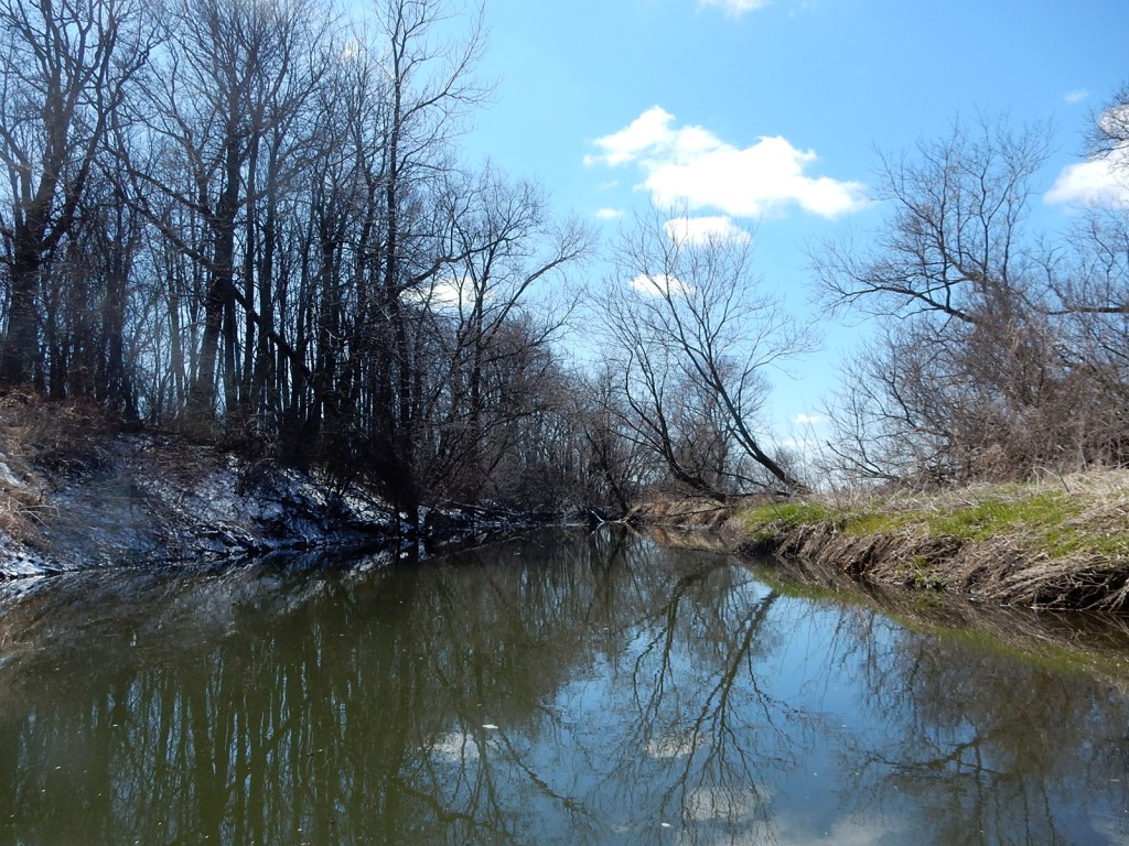
There are occasional moments between the interstate and Highway 19 where the landscape has a rugged, out-of-the-way feel to it, with little development and some attractive raised banks. There are even three drops in this section – the first a fun runnable ledge, the second (and third), two farmer fords that could be run in higher water but otherwise have to be portaged.
Cherokee Marsh is a pretty wetland complex on Madison’s northside. It doesn’t make for the most interesting paddling per se – it’s better by boots than boats – but we’re awfully glad it’s here. It does have good wildlife, however. I passed at least 15 sandhill cranes standing in the water at one point, while others swooped overhead.
What we didn’t like:
The portaging on this trip is pretty horrific, frankly. I kept thinking these two things during the ordeal: A) we should have a second website called “milesportaged.com” and this section of the river should be renamed the “Yahorror.” I stopped counting after 14 because it seemed beside the point. But the actual amount of downed trees or logjams would be easily in the 40s. Seriously.
I was pretty stubborn in the beginning by forging my way through or over obstructions without getting out of my boat. But there’s only so much one can do and after a certain point you need to just give up. Also, this is one of those environments where when you do get out and portage, it’s prudent to take a short walk to scout what lies downstream before getting back in your boat. Because there’s going to be another logjam. And then another. And another after that. Over and over, mile after mile. Fortunately, most of the land from Highway 19 to the marsh itself is public, so when you take your boat for long walks, at least you’re not trespassing. But it’s still freaking miserable.
And then there’s the marsh – 3 long miles of foot-deep water. It was initially a relief to enter it, as it meant no more portaging, and it is indeed pretty at the upper-most section, before development on both banks encroaches further south. There are only two public accesses on the marsh, one off Wheeler Road on the east bank (which cuts the lake paddling by a mile), the other at Highway 113 though technically part of a Dane County park called Yahara Heights, off of Catfish Court, where there’s a dog park. I chose the latter for purely nostalgic reasons, as it’s a place to which I’ve taken my own dog many times when I used to live on this side of town. The only bad thing about this access is it’s a 400’ walk from the dock (which was donated by Rutabaga) to the parking lot – one more “portage” after a long day of it.
If we did this trip again:
Absolutely not. Nobody should. It just isn’t worth it. There really isn’t anything redeemable about this trip.
***************
Related Information:
Yahara River Overview: Yahara River Paddle Guide
Yahara River I: Veterans Memorial Park to Windsor Road
Yahara River III: Mud Lake to Lake Kegonsa
Yahara River IV: Lake Kegonsa to Stoughton
Yahara River V: Stoughton to Stebbensville Road
Yahara River VI: Stebbensville Road to Murwin County Park
General: Village of DeForest
Good People: Friends of the Yahara River
Map: Upper Yahara River Trail
Wikipedia: Yahara River
Photo Gallery:


No Comments