 The Flambeau River begins as two major forks—the North and the South. When they become a singular branch just south of Winter, Wisconsin, they continue flowing southwest towards the Chippewa River. The South Fork is popular for whitewater paddlers where the rapids are often more technical. There is not camping on the South Fork, however. The North Fork on the other hand, is full of many camping opportunities along the most popular paddling sections.
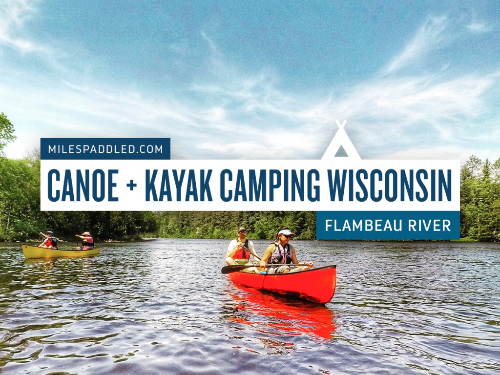
The North Fork of the Flambeau is formed at the confluence of the Manitowish and Bear rivers just east of the Turtle-Flambeau reservoir. Famous for its scenic beauty, abundant wildlife and trips that offer varying degrees of difficulty, from easy, riffly river paddling to Class II+ whitewater, there’s a section for all skill levels. Best yet, the North Branch offers canoe and kayak campers numerous campsites and landings to tailor your trips, and with multiple outfitters to get you from Point A to Point B, it’s no wonder the Flambeau is a popular canoe and kayak camping destination.
Paddling Style: River Paddling + Whitewater Paddling
Difficulty: Beginner/Intermediate/Expert
Best Suited For: Canoes + Kayaks
Camping Location: Riverside
Availability: First-Come, First-Served Designated Sites
Type: Primitive
Paddle-in: Yes | Walk-in: No
Camping Fee: No | Camping Permit: No
There are 14 well-marked and well-kept primitive campsites along the Flambeau. Each site allows for multiple parties to camp (two or three), for a total of 33 sites. All the sites are first come, first served, and there is no fee required. Camping is boat-in only and there is a one-night limit at the sites. Sites are equipped with a fire ring, pit toilet and picnic table. Showers are also available at the Flambeau River State Forest Headquarters which is located near the Highway W landing. Pro tip: Be sure to bring plenty of bug spray, because they can be overwhelming.
Nearby Campground: Lake of the Pines Campground | Reserve a Site
30 Sites. All non-electric.
Facilities: Vault toilets, water and firewood.
Nearby Campground: Connors Lake Campground | Reserve a Site
29 Sites. 4 with electric.
Facilities: Vault toilets, water and firewood.
Paddling the North Fork of the Flambeau River:
Starting with tame river paddling and wide expanses perfect for fishing to more skilled whitewater later on, the North Fork has it all. And it kind of goes in a green light, yellow light, red light type of order.
9 Mile Creek to Dix Dox Landing
Miles: 11.5 | Skill Level: Beginner | Guide
9 Mile to Dix Dox Landing is a very popular section and is good for all skill levels, even beginners with moving-water experience. Between alternating quietwater, riffly stretches and mild Class I rapids that aren’t too technical, paddlers will enjoy a slower ride but with a usually steady current along heavily-wooded banks. Be prepared to dodge the many rocks along the way. The last six miles are spent paddling around a large Oxbow which ends at the fittingly-named Oxbo at Dix Dox Landing. This is also a very popular section to fish for musky, walleye and smallies.
Dix Dox Landing to Camp 41 Landing
Miles: 18 | Skill Level: Intermediate | Guide
Dix Dox Landing to Camp 41 is very similar to upstream but offers a few more Class I + II rapids in the last few miles. Starting wide and calm, this section is good for novice paddlers who can read a current to avoid the many submerged rocks and boulders. About a mile and a half before the Camp 41 Landing, there’s a long series of riffles and Class I-II rapids called Porcupine Rapids, which are the largest on this section, but they can be easilly portaged.
Camp 41 Landing to Beaver Dam Landing
Miles: 11 | Skill Level: Expert | Guide
This is the most popular section on the Flambeau for whitewater paddlers and it’s a bit more rugged and wild than the upstream sections. Also wider than the previous sections, it begins immediately with Class II rapids and courses its way to Cedar Rapids, which is a solid Class II rapid, followed by a series of four Class I-II pitches through boulder gardens. Beaver Dam Rapids is the largest drop – a solid Class II+ which drops 4 feet – and should be scouted and only run by experienced paddlers. In higher water, it creates serious backrollers and sadly, people have lost their lives there.
Essential Information:
General Info: Paddle Flambeau
General Info: Wisconsin DNR
General Camping Info: Wisconsin DNR
General Paddling Info: Wisconsin DNR
Maps + Guides:
Flambeau River State Forest Recreation Map
Flambeau River State Forest River Camping Brochure
Wisconsin Trail Guide to the Flambeau River
Recommended Routes:
9 Mile Creek Landing to Dix Dox Landing
Highway W Landing to Flambeau Lodge Landing
Robinson Landing to Holt’s Landing
Outfitters:
Big Bear Recreational Rentals
Flambeau Sports Outfitters
Nine Mile Tavern
Photo Gallery:


No Comments