Newald Tower Road/Forest Road 2159 to Highway 101:
One of the first three rivers to be classified as Wild & Scenic in Wisconsin, the Popple River throbs through the heart of national forest and offers paddlers a splendid mix of calm tranquility surrounded by an undeveloped, natural landscape plus a few adrenaline-spiked rides down Class I-III rapids. Not to mention some of the oldest bedrock in North America, clocking in at 2 billion years old. This trip features the best of the quintessential mid-section of the Popple, downstream from the lowland alder thickets and beaver dams but upstream still from its confluence at the Pine River.
Rating: ☆ ☆ ☆ ☆ ☆
Trip Report Date: July 4, 2020
Skill Level: Intermediate (except for the rapids, which are Intermediate/Expert, or can be portaged around)
Class Difficulty: Class I-III
Gradient:
≈ 1-2′ per mile in the quietwater sections, 4-6′ per mile in the riffles, and 15′ per mile in the “falls.”
Gauge Recorded on this Trip:
Fence: ht/ft: 2.75 | cfs: 132
Recommended Levels:
This is the recommended minimum level. Scraping can be expected in the shallow areas, and the rapids/falls will be bony and require a lot of boulder-dodging to avoid getting hung. Look for at least 200 cfs for a smoother ride for recreational paddling. Whitewater enthusiasts will want a minimum of 400 cfs. Also, there’s a staff gauge at the Highway 101 bridge (this trip’s take-out). Look for a bare minimum of 0.68′ but preferably at least 1′ (which correlates to 100 cfs). Ideal levels are between 1.00-1.60.
Put-In:
Newald Tower Road/Forest Road 2159, Armstrong Creek, Wisconsin
GPS: 45.75754, -88.52767
Take-Out:
Highway 101, Florence, Wisconsin
GPS: 45.79995, -88.39662
Time: Put in at 1:50p. Out at 7:15p.
Total Time: 5h 25m*
Miles Paddled: 10.25
*Time Note: Admittedly, this is a long time on the water for only ten miles. We did picnic, plus we scouted both “falls” and a couple of the rapids – which we strongly encourage everybody to do as well. The river was very low as well, which contributed to our slacker pace. Plus we were on vacation, with the longest days still on our side, and it was very hot this weekend.
Wildlife:
A million mergansers, teeming songbirds, an otter, a fun toad, deer, kingfishers, dragonflies and lots and lots and lots of flies.
Shuttle Information:
12 miles. Virtually all on dirt-gravel national forest roads which would be an unpleasant workout via bicycle.
Background:
Together with the Pine River, its sibling twin running parallel to the north, the Popple is one of the three original rivers designated as Wild and Scenic and protected by legislative fiat in 1965. (The third is the nearby Pike River.) This law – which today seems like radical activism bordering on “conservation porn” – prevented any development along the banks of these rivers and safeguarded a protected corridor from the water from development as well as various industries the likes of dams or logging. (That said, anything pre-existing 1965, such as cabins, private property, and yes, one big mother of a dam on the Pine, all are grandfathered in.) What’s especially notable about this is Wisconsin, according to Mike Svob, guidebook scribe extraordinaire, was the first state in the nation to pass its own Wild Rivers Act, independent of the federal government.
(We also started Earth Day, kindergarten, coffee breaks, and organized labor – all of which, again, in today’s political climate would be pie in the privatized sky.)
The result is an absolutely admirable nook that nearly has the look and feel of a national park located entirely in one county in northeastern Wisconsin – Florence County. There are designated Wild & Scenic Rivers signs all over the 100 miles of adjacent roads with corresponding places of touring interest, whether that’s a hiking trail to a waterfall or access to a river, not to mention the dozens of National Forest signs for various campgrounds and lakes. (Bear in mind – no pun intended, though there’s a very decent chance you will in fact see bear up in this neck of the woods – that when we say signs “all over the roads” that there really are only five main/paved roads in an area that is some 250 square miles large. The designated Wild & Scenic Rivers swath of land is like a wide rectangle with paved highways at each end and one that runs on a diagonal through the middle.) All the other roads in between are unpaved national forest roads. It’s a rugged place – truly wild and scenic.
By and by, there are three paddle trips on the Popple River, as follows:
Upstream: Highway 139 to Newald Tower Road
Midstream: Newald Tower Road to Highway 101
Downstream: Highway 101 to the Pine River confluence
Mike Svob lays out two trips in Paddling Northern Wisconsin, the first of which begins in the middle of the upstream segment and ends in the middle of the midstream segment, the second of which begins in the middle of the midstream segment and ends at the Pine River confluence. The excellent Wisconsin Trail Guide likewise covers these very two sections of the Popple. If you have two days to paddle the Popple, these are the trips you should do. But, if you have only one day, like us, then you have a dilemma. We recommend the midstream section – which is this trip. Upstream can be tricky with low water levels, thick alders and beaver dams, and mainly quietwater but for a fun Class I rapids. Downstream has two notable Class II-III rapids but a logistical conundrum in accessing a take-out: you must either paddle upstream for a mile on the Pine River to Highway 101 (seven-ish miles downstream from the Highway 101 bridge crossing on the midstream trip) or driving down a notoriously unreliable dirt-mud road right at the confluence). So, either slog for a mile through Upstream Alley or drive down “Dodgy Lane” where you might get stuck and stranded.
Hence the appeal of the midstream trip, which offers excellent accesses and an easygoing balance of serene quietwater, frisky riffles and a few fabulous Class II-III rapids.
Overview:
The put-in at Newald Tower Road/Forest Road 2159 is on the downstream side of the bridge on river-right, where a feint path leads from the road to the river. Just upstream you’ll see and hear the end of an attractive boulder garden that, alas, can be run only by paddling the “upstream” segment of the Popple. It’s nothing to feel sore about; there are boulder gardens galore on this trip. And while the river will look a little wider than you might have imagined right at the bridge, it’s only an aberration; by and by, the Popple’s width on this trip is generally about 40′.
The South Branch of the Popple River will come in on the right only a thousand feet from the bridge. The current is admittedly slow here at the beginning of this trip, but the river environs are positively lovely and picturesque. Root beer-hued water, a sand-gravel bottom, boulders scattered here and there like glacial crumbs, and simply miles upon miles of tree-lined banks with a quintessential northwoods feel. So what if the current is slow? What’s your hurry anyway?
The first glimpse of rapids, and a fair dress rehearsal of what’s to come later on, appears about two miles into this trip. The river will bend to the left and then ease rightward into an attractive Class I boulder garden with a distinct pitch downstream. At the base of this pitch is a Class II rapids that, at low water levels like ours, is parched and laden with exposed boulders making it a tricky and bony run. One of us ran it, while the rest of us heeded the yellow Portage sign on the right and skipped what looked like minimal reward for maximum risk of banging up a boat badly. (Uff-da indeed!) It’s a scenic spot whether you run it or not.
Several long, slow straightaways follow, as well as a couple minor creeks coming into the Popple on river-right. But the scenery is just stunning! Miles of unspoiled landscape with lowlands and wooded banks comprising a mix of deciduous and conifers, big erratic boulders hither and yon. Incidentally, now’s as good a time as any to offer this fun fact: the word “Popple” has two meanings – one is a type of tree (basically the same as a poplar), the other is rapids or choppy water. It’s perfect how fitting both connotations are for this wild and scenic river!
A few handsome cabins will signal the first bridge, which itself marks the approximate halfway point for this trip. Advance apologies for confusion, but the road here is the same forest road as the put-in – FR 2159. The distinction here, however, is this one is better/also known as “Morgan Lake Road.” A rugged boulder garden awaits on the downstream side of the bridge as well as the beginning of various rock outcrops from this point forward, both along the shore and exposed as bedrock beneath the water surface. By and by, the landscape west of here is covered in glacial till, with little signs of exposed rocks. But from here on the river enters a different geological area called the Niagara Fault Zone. Both the Popple and Pine Rivers in this zone are from the Pre-Cambrian Era, dating back some 2 billion years old and making them thus some of the oldest known rock formations in North America.
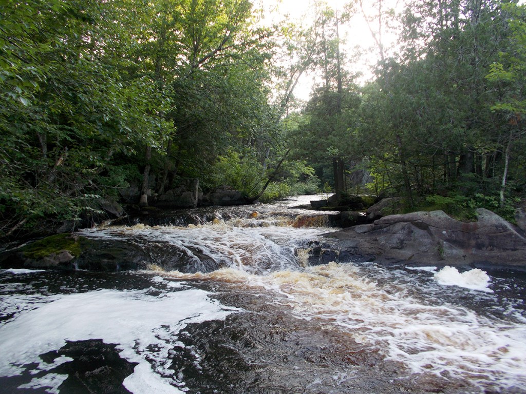
That might all sound a little stuffy or abstract – no one’s gonna ask to buy you a drink after you begin talking about the Quinnesec Formation of the Penokean Range at the next happy hour. (Well, I would – and not just for the opportune wordplay of asking a geologist if she like her drinks on the rocks.) But it’s much easier to appreciate the show of this rather than the tell of it only a quarter mile downstream from the Morgan Lake Road bridge, where Little Bull Falls plunges over exposed bedrock and dozens upon dozens of boulder gardens in a total run that is a third of a mile long. The so-called “Falls” are of course the most dramatic feature and constitute a respectful Class II-III on the whitewater scale (depending on water volume), but it’s really just a drop of about 4′. Lesser rapids both precede and succeed this drop and demand your attention as well due to their squirrely sequencing and boulder-strewn maneuvering. Scout on the left and/or portage it, where too you’ll pass a gorgeously phantasmagorical, ghostly gray cabin like out of some Viking-era saga nooked away in a fjord or tundra. It’s not for nothing that whitewater paddlers or just those who wish to paddle the “downstream” segment of the Popple begin at Morgan Lake Road.
The banks will rise, many of which will be studded with granite, gneiss and basalt rock outcrops. Additional boulder gardens resume here and there, but long stretches of quietwater prevail as well. The next set of notable rapids comes about 1.5 miles downstream, called Murphy Rapids – good, clean fun at Class I-II, and a ¼-mile-long at that. Likewise, after another quietwater spell of about 1.5 miles, a subsequent set of Class I-II action comes at Nine Mile Rapids (this one even longer). Both of these are plenty intuitive and should pose no problem for paddlers. Now, the same cannot be as charitably extended to the next rapid ¾-mile downstream, Big Bull Falls, a reputable Class II-III (again, depending on water volume) drop that is preceded by 600’ of riffles and Class I’s. As before, look for the Portage trail sign. Both Svob’s book and a DNR periodical affirm that the portage is on the left, but we went right (no doubt because of a sign there telling us to). You should at least scout the so-called “falls” or simply portage around them. A small cedar-topped island splits the river in two channels. Most paddlers opt for the right channel, as it comprises two 3-4′ ledges and typically has more water volume. The left channel also has two ledges, but the first is 6-7′ tall and surrounded by irregularly angled boulders, plus there’s less water volume here, making a clean run difficult and dangerous. Either way, spend a moment here, as it’s one of the prettier waysides along the Wild & Scenic highway.
There’s only ¾-mile remaining before the take-out, and it’s a zippy end to what now feels like an adrenaline-jacked experience (after Big Bull Falls) loaded with riffly fun and Class I boulder gardens. Alas, soon enough the bridge at Highway 101 will appear, signaling the end. There’s a basic landing on river-left about 300′ downstream from the bridge, off a short jaunt from a dedicated parking area.
What we liked:
This river, and this trip in particular, is spectacularly picturesque. Even if you knew nothing of its protected status and unique designation as “wild and scenic,” you’d still know that something special was going on. Most places just don’t look like this! (That they should – and could – is another whole topic.) Blessed are the lawmakers who, being from a very different time, had the vision and courage to set aside their political divisions and protect what is, after all, only paper-thin slivers of land from development and the whining, annoying noise of the internal combustion engine on the water. Given the gallery of rogues in the current State Legislature (indeed, since 2011 especially), where the common notion of the Public Trust doctrine and the Wisconsin Idea have been shoved under the bulldozer and cement mixer of “economic development” and property-owner “rights” – we’re looking at you, Tom Tiffany – bills the likes of a state-designated “Wild and Scenic Rivers Act” would never, ever go farther than a daydream shared between conservationists, silent sports enthusiasts, and sympathetic progressive politicians.
On the one hand, the result is so simple as to be innocent – the river today looks and feels and acts the way it did half a century ago (and arguably as it has for a very, very long time). But on the other hand, access like that to the past and to an almost nostalgic escape from the entrapments of modernity is truly radical. To make an imperfect analogy, while seeing a Packers game in person is a timeless experience (and rite of passage for most Wisconsinites), Lambeau Field itself is a very different place than what it was 50 years ago, to say nothing of the basic rules of the NFL. Naturally, paddling a river is very different. But even a contemporary recreational kayak – which simply didn’t exist in the 1960s – that’s why the old guidebooks refer to canoeing – still acts as a passport to an exotic place which manifests a sense of timelessness.
I’ll stop waxing poetry and politics. It’s a damn pretty place with quiet interludes as serene and picture-perfect as can be in between ass-kicking rapids that’ll make you want to hoot and holler and Yawp from the bellows of your lungs!
It’s an extraordinary daytrip – the intimate width of the river, the hue of its water, its tranquil timelessness, its boulder gardens and rugged outcrops, and of course those challenging, exhilarating rapids.
What we didn’t like:
What… you didn’t think all those good vibes would come without a price, did you?
Let’s get one incidental out of the way: shallow water levels. While we were able to mainly bump and scrape by the shallows, the trip would’ve been way more fun if – say it with me — there had been just another couple inches of water. So, please do yourself a favor and paddle this at least a little higher than our levels. It’s worth repeating: look for a bare minimum of 0.68′ but preferably at least 1′ on the staff gauge at the Highway 101 bridge. Ideal levels are between 1.00-1.60.
There are two main things we didn’t like, plus one thing that disappointed us. The latter was the lack of wildlife – other than a lot of mergansers, the fauna cameo appearances were underwhelming. But that may well have everything to do with the weather: it was hot – in the 90s hot. (Which, perhaps along with the shallow levels, explains why we saw no other paddlers at any point on or off the water, despite it being the 4th of July weekend. As our friend Mitch quipped, “You think this river would be more Popple’r.” Hey-o!) So, the two dislikes were the long and often disorienting shuttle on slow dirt, gravel roads with ambiguous-at-best signage, and the also-slow stretches of flatwater between the fun rapids. For the shuttle, just make sure you have a reliable map with the route clearly on it. (There’s a good chance your phone won’t work out in these woods.) Of the four kayaks we had, three were crossovers, which make for tedious slogs when the current is slack. Certainly worth the price of admission, but a bit of a drag on a ten-mile paddle with a heat index pressing 100 degrees.
If we did this trip again:
Essentially, we’d do everything the same again – other than adding a few more inches of water. We stand by our idiosyncratic trip of combining the best/least complicated sections of the more conventional and publicized segments of the Popple River. This trip offers the best of the best with the least of the “worst.” That said, since we’ve now already experienced the clip between Newald Tower Road and Morgan Lake Road (aka the two FR 2159 bridges), we’d either begin at Morgan Lake Road and continue onward to the Pine River confluence or, wilder still, begin at Highway 101 and paddle down to the WE Energies dam (which would include 22′ La Salle Falls…which we’d probably portage).
***************
Related Information:
Brochure: Canoeing the Wild Rivers of Florence County Guide
Brochure: Pine and Popple Wild Rivers
Camp: Pine and Popple Wild Rivers
General: Florence County
Guide: American Whitewater (Newald Tower Road to Morgan Lake Road)
Guide: American Whitewater (Morgan Lake Road to Highway 101)
Guide: Wisconsin Trail Guide
Wikipedia: Popple River
Photo Gallery:


No Comments