
Shantytown Road to Jordan Park:
A long daytrip that’s not without its perks – wild-feeling woods, abundant wildlife, a boisterous boulder garden, spooky floodplains, gorgeous water clarity, and fun sandy undercut banks – but this stretch of the Plover River does feel a bit monotonous at 14 miles. Fortunately, alternative accesses provide shorter trips for paddlers to skip the redundant stuff for more quality time on the water before asking “are we there yet?”
Trip Report Date: May 18, 2019

Skill Level: Intermediate
Class Difficulty: Flatwater + Two Class I rapids
Gradient:
≈ 3′ per mile
Gauge Recorded on this Trip:
Kelly (Eau Claire River): ht/ft: 1.50 | cfs: 380
Current Levels:
Kelly (Eau Claire River): ht/ft: 0.92 | cfs: 178
Recommended Levels:
We recommend this level – which is higher than normal – but bear in mind that it’s only a correlation gauge, a decent but not perfect indicator. Generally speaking, water levels are usually reliable.
Put-In:
Shantytown Road, Shantytown, Wisconsin
GPS: 44.6991, -89.44396
Take-Out:
Jordan Park, Stevens Point, Wisconsin
GPS: 44.57808, -89.50078
Time: Put in at 1:15p. Out at 6:15p.
Total Time: 5h
Miles Paddled: 14.25
Wildlife:
Great blue herons, sandhill cranes, a beaver, songbirds galore, a lot of deer, geese, turkey vultures and wood ducks.
Shuttle Information:
11.6 miles, pretty much a straight shot from Jordan Park to Shantytown Road. Perfectly fine for bicycling. One recommendation: turn the radio to local radio station 90FM (technically 89.9 FM), WWSP. Not only will you get a taste of what’s happening on the local scene, but you’ll also either hear tunes you hadn’t remembered since you were in your late teens or wonderfully obscure stuff you’d never hear elsewhere – not even Spotify or Pandora.

Background:
We paddled this section of the Plover the day after our super-fun trip from Jordan Pond to Iverson Park, essentially by ending where our first trip began, in effect working backwards from downstream upwards. Unfortunately for us on this occasion, the weather was laughably awful: a high of 47 degrees, a 48-hour forecast of overcast drizzling, and a 20 mph wind (mercifully at our backs for the most part).
So, why take on a 14-mile-long trip in such conditions (or any length trip at all)? Because we wanted to complete all the Plover River miles in Portage County as part of our collaboration with the Stevens Point Area Convention & Visitors Bureau. Also, we couldn’t help from wondering why Meister Mike Svob, in his iconic Paddling Southern Wisconsin, began his trip for this section of the Plover at Bentley Road, a good 5.5 miles downstream from where his previous trip ended at Shantytown Road (technically, in Marathon County, but just above the county line). We’re a little incorrigibly OCD as river “completists,” so we had to find out what lied in between Shantytown Road and Bentley Road, and why it was omitted.
Spoiler alert: Because it is, to quote from my kayak notebook, “dumb and boring.”
Overview:
The put-in at illustratively named Shantytown Road is entirely adequate and comparable to most of the bridges over the Plover up- and downstream: there’s room enough along the shoulder to park a vehicle and typically a gently sloped, short path leading to the water. (Seriously, “Shantytown”? Is that an ironic joke or a pitiful misfortune?) There are two options from which to launch a boat, both on the downstream side of the bridge. We opted for the one at river-left because there’s a peculiar but convenient place to park a vehicle off the road located next to it.
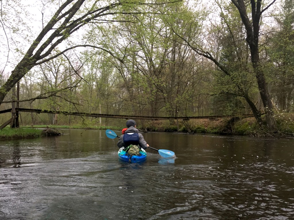
And as is the case with the segments upstream, the banks of the Plover here are lined with pines through a wondrously woodsy corridor, and the water itself takes on that beloved root beer hue thanks to the sand-gravel bottom and peppy current. At times, the woods will recede some, which in turns allows for long views of some pleasant hills in the background. The sense of solitude is palpable, as there are no signs of civilization in the first couple miles. That, along with the current, will change as the river widens, and slowly flows past a series of farms, starting with the first building on this trip, a red barn on the right. The change in scenery is fairly abrupt, as are the effects of the Bentley Pond (aka Dana Pond) dam at County Road Y. At a certain point, the current just dies. In the high heat of summer, it’s easy to imagine this section becoming an insufferable slog, between the algae blooms brought about by phosphorous runoff from the adjacent fields together with natural occurring lily pads and aquatic grasses, and of course the tremendous amount of silt backed up from the dam.
The dam itself is well marked, including a TAKE OUT sign pointing towards the left… but don’t look for any designated place at which to take out, as there aren’t any. We got out by the weathered barn, schlepped over the berm, and re-launched off the grassy rocks below the dam. Back on the water, the Plover looks beautiful again: clear water, good current, piney banks – classic Central Wisconsin. A small stream enters stage left, adding a little volume to the Plover as it meanders this way and that around a beautiful house on the left and then under the bridge at Bentley Road. Here, on downstream-right, is where Svob’s “Plover River 2” trip begins. For our purposes, Bentley Road comes in at 5.6 miles down from Shantytown Road.
In the next few miles the river is less wild-feeling and a bit more crowded by development than upstream, but it’s still very pleasant with pine-lined banks (mostly on the left) and dozens of small grassy islands creating fun side channels. There are downed tree obstacles to dodge, but there should be ways through, under, or over, without having to get out and portage around. (Alas, one of these led to me tipping and going for an unwelcome swim, but I’ll get to that later.) While wooded on the left, the right-hand side is marshy and spacious. About midway between Bentley Road and the next bridge at County K, off to the left, is the Steinhaugen Recreation Area, 280 acres of hiking and XC-skiing trails and public hunting grounds through a mix of upland forest, prairie, and wetlands. It’s accessible by Bentley Road and a lovely place for a post-paddle jaunt.
The bridge at County Road K comes next, technically a triple culvert, which we always find fun. An alternate put-in/take-out is on downstream-right. From Bentley Road to County Road K are 3.25 miles. From County Road K to the next access, at a partially removed dam, are about 4 miles. And from there to the take-out at Jordan Pond are a skimpy 1.5 miles. This next section feels more remote, even though there’s a road that basically parallels the river on the right the entire time. The payoff is that there’s no development on the left. Following some meandering, an enormous farm complex with no fewer than five silos will be found on the right. But then the river slips back into the woods and past an attractive undercut sand bank that foreshadows the final trip on the Plover below the last dam, towards Stevens Point. Starting with a fun suspension bridge, the first of two quaint footbridges will be found in this dense forested area.
The landscape will open up, just like that. You’ll be forgiven for finding the change in scenery somewhat surreal and sudden. The area is still recovering from having been submerged by the Van Order Dam that created a former pond as long as 20 years ago. Take a look at the satellite image of the map below to appreciate the contrast from piney forest to sudden treeless barrens. (In summertime it would look prettier and less spartan. But in mid-May, on this dreary, cold, bedraggled day, it was neither sight nor site for sore eyes.) A straightaway precedes the remnants of the dam, and, as always, you’ll hear the rapids and see the subtle horizon line before you encounter them. You can portage around the rocky Class I rapids on either the left or right, but for us the water was high enough to run it, which we did a little left of center with no difficulty. You’ll pass this spot during the shuttle – look for the big dilapidated red building – so it’s a good idea to take a look at it first to determine if it’s runnable. Allegedly, according to Rick Kark’s account, of paddling the Plover, the owner of the dam still owns the rights to it and in theory can build a new one in the future. But who knows whether that will ever happen… We hope it stays as-is. Whether you run this drop or not, you can take out here if paddling across Jordan Pond is not your cup of tea.
It’s only 1.4 miles to the take-out at Jordan Park, most of which is the flatwater of the dam impoundment creating the pond. But before you enter the pond the river gallops through a very attractive wooded section. Just below the small bridge at Sharonwood Lane is a scenic little boulder garden that treated us to lively rips before spilling out into the pond proper. Jordan Pond is a handsome little body of water in its own right, and even offers three designated canoe/kayak campsites on the right shore (along with picnic areas, a boat launch, and a campground). But expect to share the pond with motorboats and the like. And, as with Bentley Pond before, silt backup and weeds, because Jordan Pond also is an artificial impoundment of the Plover River created by a dam (on the opposite side of Highway 66). There are two location options for taking out, both at Jordan Park, both on the right: the first is designated for paddlers near the canoe-kayak campsites; the second is 1000’ further down shore at a boat launch.
What we liked:
The accesses are all generally good in terms of getting onto/out of the water as well as tailoring this section of the Plover River to various trip lengths, depending on the paddler’s preference. We loved the pine-lined banks and thick wooded segments, the root beer-hued water together with its sand-gravel bottom and reputable current, and the fun little rapids sections. It’s not as dramatic as other sections of the Plover further upstream, or as tranquil and undeveloped as the next section downstream, but it still makes for a very fun day trip.
Also, after our adventurous/arduous paddle, we drove four miles east on Highway 66 to Matero’s Pub & Pizza, for a restorative meal (the shrimp alfredo is indulgently delicious) and deserved dessert beverage (who’s a cute little pink squirrel?). Additionally, just northeast on Highway 66 is the nearby town of Rosholt, which offers several outstanding stopover establishments for food and drink. The Brick Pit House does very recommendable barbeque, McZ’s Brew Pub features great pizza, and Kozy Yak Brewery & Winery specializes in house-brewed beer and wine. All three of these venues are on the same block of Main Street. While on your way out of town is Wisconsin Territories, which, despite the greenhouse and assorted floral arrangements, quaint jars of mustard, honey, and maple syrup, offers a dozen made-from-scratch sandwiches (most of them hot) that are shockingly excellent.
What we didn’t like:
Falling in the water when it was 47 degrees outside, intermittently drizzling, and still facing eight additional miles to paddle before reaching the car! Yeah, that part kind of sucked. So what happened was this: instead of snapping a strainer limb from a downed tree with either forward momentum or backward, I did so sideways, as I passed it to my right. It snapped off much more easily than I’d anticipated, meaning there was just no real resistance, with the result that I had too much force going sideways and lost my balance. And, man, all it takes is just an inch or two leaning the wrong way and suddenly your boat is filling with gallons of water over the lip of the cockpit…and before you know it, it’s fully full, and you’re fully [expletive deleted]. As the saying goes, no good deed goes unpunished.
Fortunately, I had a change of clothes in my dry bag. Unfortunately, because I was submerged neck to toe, my erstwhile waterproof boots were soaked. My seat was soaked, so even the dry clothes still got wet just from sitting down. (Note to self: pack either a garbage bag or add rain pants to the dry bag ensemble. And while you’re at it, how about a spare pair of gloves?) I never did get warm, but I was fine for the remainder of the trip; I didn’t shiver or start mumbling or have any of the first signs of hypothermia. (An additional benefit to wearing one’s PFD, especially in cold weather, is the extra layer of core warmth it provides!) We did consider just bailing on the trip outright by taking out at any of the alternate accesses and just walking back to the car, but that A) didn’t seem like very much fun whatsoever and B) we reasoned that it would likely take as long to walk as it would to paddle – so we might as well keep on keeping on.
So, it’s hard for me personally – circumstantially – to separate that individual incident with other matters I didn’t particularly like on this trip. But really the only complaint is Bentley Pond and its dumb dam. The pond is only 86 acres, but the effects of the dam can be felt for several miles upstream. This dam, as with so many others in the area, was built originally for the sake of a sawmill. Needless to say, those pioneering pinery days are a thing of the past. So what purpose does it serve today? Beats us. But it’s hard to drive down County Y and see all of those big farms and fields adjacent to the river without putting one and one together. After all, the Little Plover River has garnered attention for becoming totally dry on account of the regional high-capacity wells. Regardless, the fact that there is a dam and necessary portage around it with no intentional portage area for getting out and then back in, is a little frustrating. I mean, it’s “Portage” County, after all! Jokes aside, we just thought that there’s really no benefit to starting this trip at Shantytown Road.
Or snapping off stray tree limbs.
If we did this trip again:
It’s always fun to explore new places, even if what you discover is the reason why you’d never heard of such-and-such a place before. In this case, the five+ miles between Shantytown Road and Bentley Road. Even though Mike Svob doesn’t mention anything about this section, one can read between the lines or interpret it as a telling omission. While it starts off very nicely, the enervated current, marshy pond impoundment, and predominating farms spoil the river paddling effect. It took us only ninety minutes to paddle this segment, but it’s an hour and a half better spent elsewhere.
The much better section of river is from Bentley Road, or even Highway K, to Jordan Park. We’d do that again in a heartbeat, because it’s fun and pretty.
***************
Related Information:
Plover River I: Jordan Park to Iverson Park
Plover River II: Esker Road to Bevent Drive
Plover River IV: Boundary Road to Kristof Road
Camping: Collins County Park
Camping: Jordan County Park
General: Stevens Point Convention & Visitors Bureau
Guide: Paddling The Plover
Guide: Paddling Southern Wisconsin
Outfitter: Nature Treks
Wikipedia: Plover River
Photo Gallery:
Mea culpa: The images below are blurry due to a camera debacle that occurred a month before this trip. It supposedly was repaired by the manufacturer (or their assigned lackeys), but “clearly” that was not the case. I apologize that most of the images are out of focus. And, well, needless to say, the camera was done no favors during the intermittent drizzle and limb snap snafu.


No Comments